
From Sensors
to Systems Intelligence.
Skovomax integrates GeoAI, LiDAR, machine learning and spatial interaction models to understand, predict, and manage complex real-world systems — from photon to policy.
Four systems. One measurement philosophy.
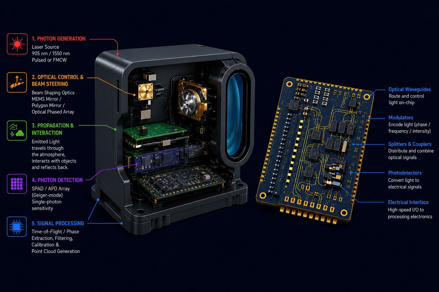
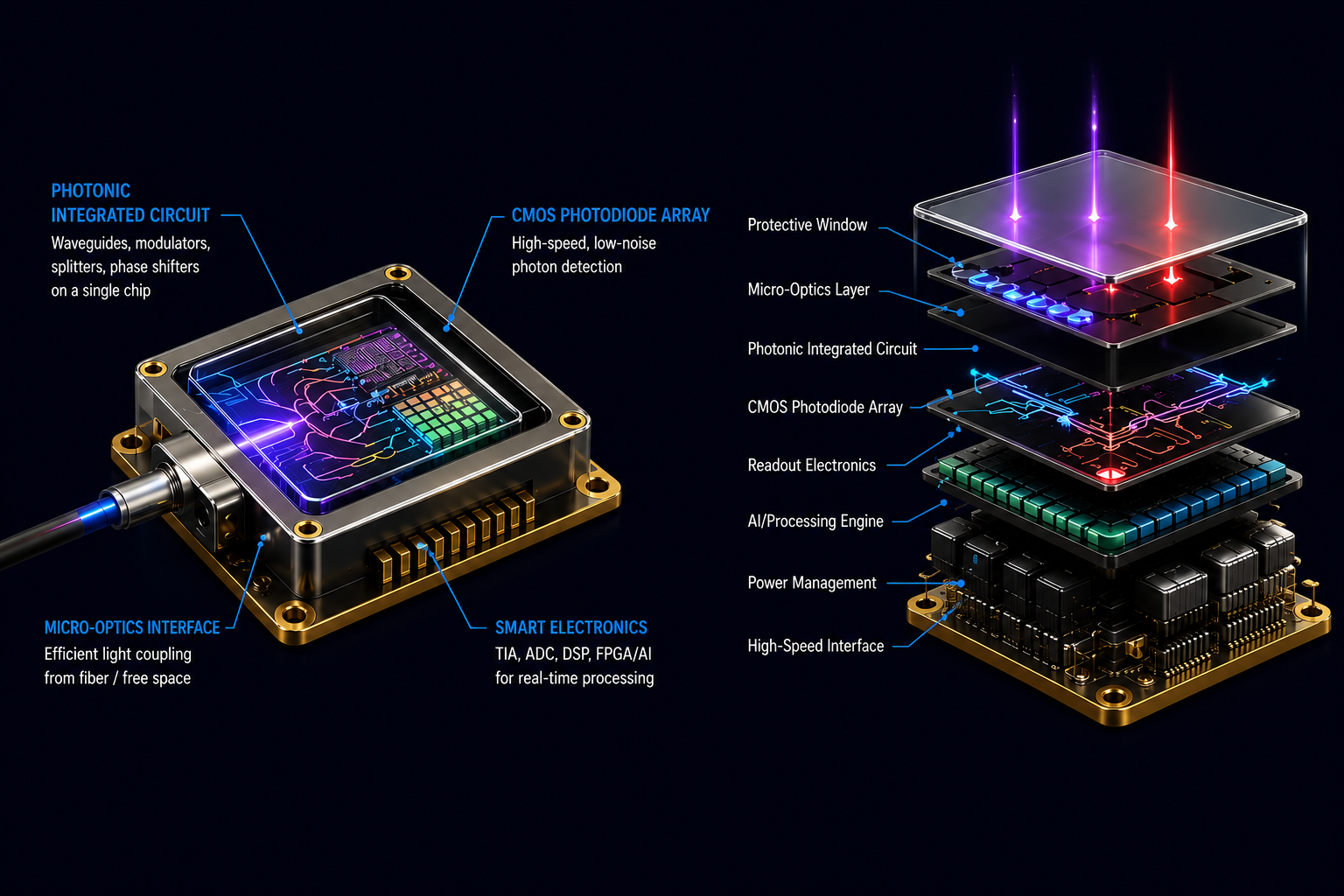
We treat sensors as light-based measurement systems — emission, interaction, detection, timing, reconstruction — and build the analytics layer that turns those measurements into structured intelligence.
Systems thinking,
photon to policy.
We do not sell modules. We design closed loops — where sensing, modeling, and decision-making are engineered as a single continuous system.
Physical World Sensing & Reconstruction
LiDAR, hyperspectral data, and sensor fusion to reconstruct real environments in high resolution. 3D modeling (LOD2–LOD5), utility corridor analysis, vegetation–infrastructure interaction, digital terrain and surface models.
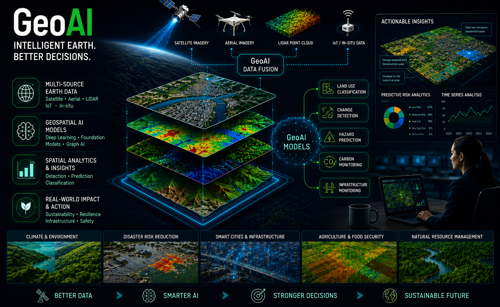
GeoAI & Pattern Intelligence
Machine learning to extract hidden structure from spatial data. Feature extraction from imagery, classification from point clouds, deep learning for geoscientific discovery.
Climate & Hazard Systems Modeling
Predictive models for environmental risk — flood, wildfire ignition, levee failure, extreme events — integrating ML with SAR, remote sensing and topographic factors.
Human–Environment Interaction
Modeling how human activity shapes spatial outcomes — disease spread, mobility-driven risk, socio-economic vulnerability, spatial diffusion.